
It’s official, it’s live
The Morocco offroad guide,
in three roadbooks.
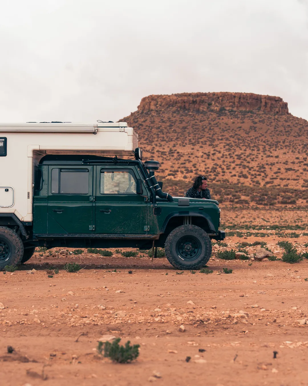
Two years in the field, three routes, one Morocco offroad guide to drive on your own. It’s no longer a promise: the three volumes are online and downloadable right now, from €59. Nador to Tata, Tata to Agadir, Tata to Chefchaouen. 3,943 km of route, 2,343 km of it offroad, all driven in our Defender 130.
Online at last
Our Morocco offroad guide in three roadbooks
We could have piled it all into a single file. The country doesn’t allow it: between the hamadas of the south, the Atlantic cliffs and passes above 3,000 metres, these are three trips with nothing in common. So we split our Morocco offroad guide into three standalone roadbooks, drivable separately or end to end. Nador → Tata and Tata → Chefchaouen are €59 each, Tata → Agadir is €79. Every volume comes as a PDF with the GPX tracks, downloadable within the minute.
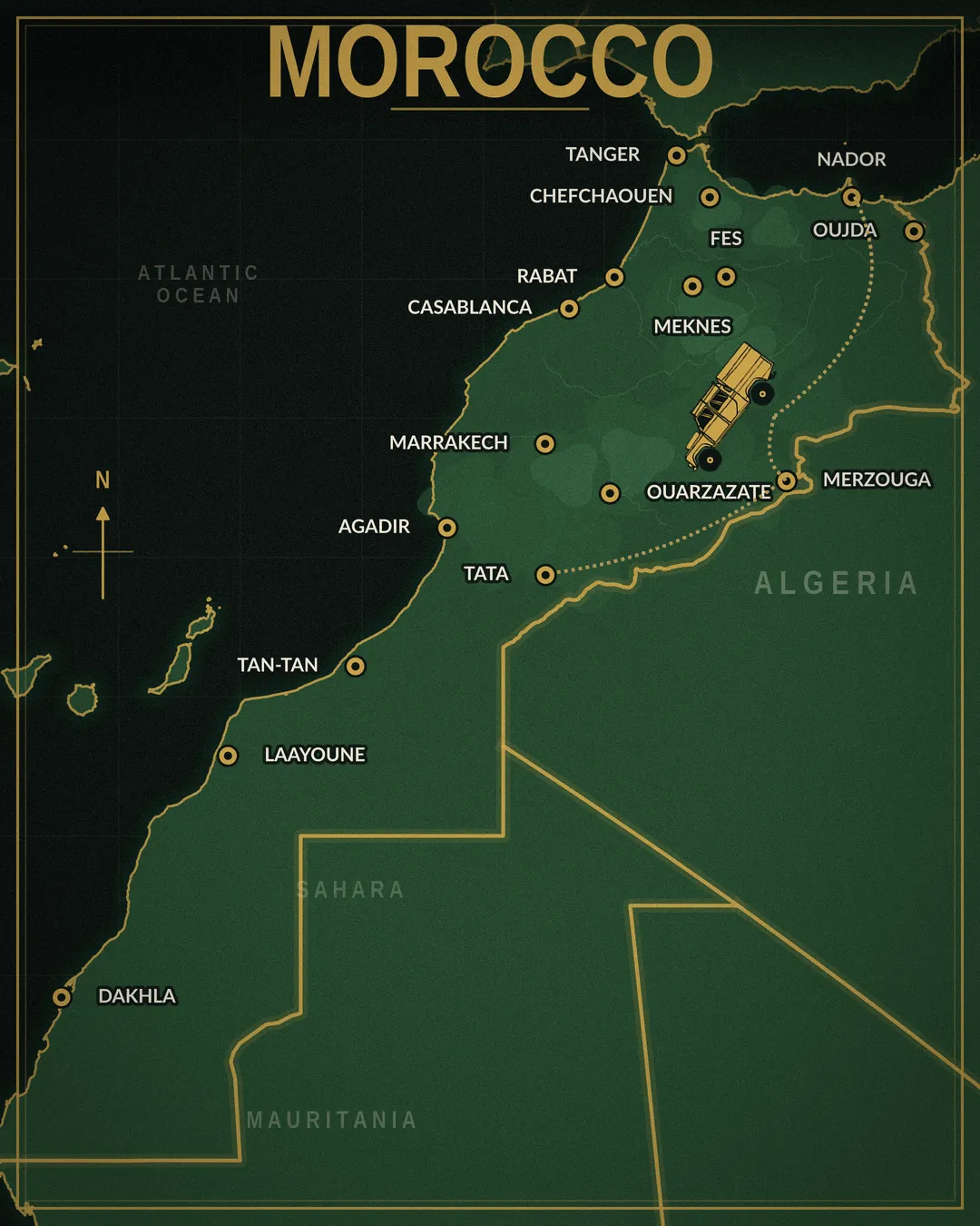
Nador → Tata
The run down to the Sahara. The volume with the most dirt in it: hamadas running to the horizon, passes cut like staircases into the rock, dune seas and dry riverbeds that serve as your road for hours.
- 1,525 km, 980 km of it offroad
- 47 waypoints, 5 alternatives
- 7 to 10 days, September to May
PDF + GPX tracks
See the roadbook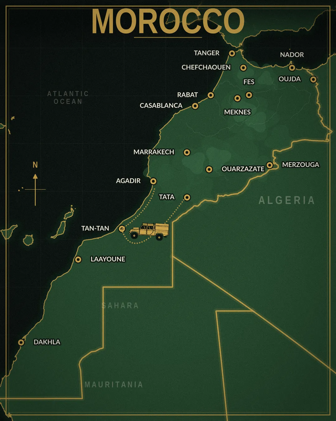
Tata → Agadir
The volume where the desert opens onto the ocean. Ergs, hidden palm groves, forgotten forts, then fishermen’s camps and kilometres of beach you can drive.
- 918 km, 613 km of it offroad
- 35 waypoints, 4 alternatives
- 7 to 10 days, September to May
PDF + GPX tracks
See the roadbook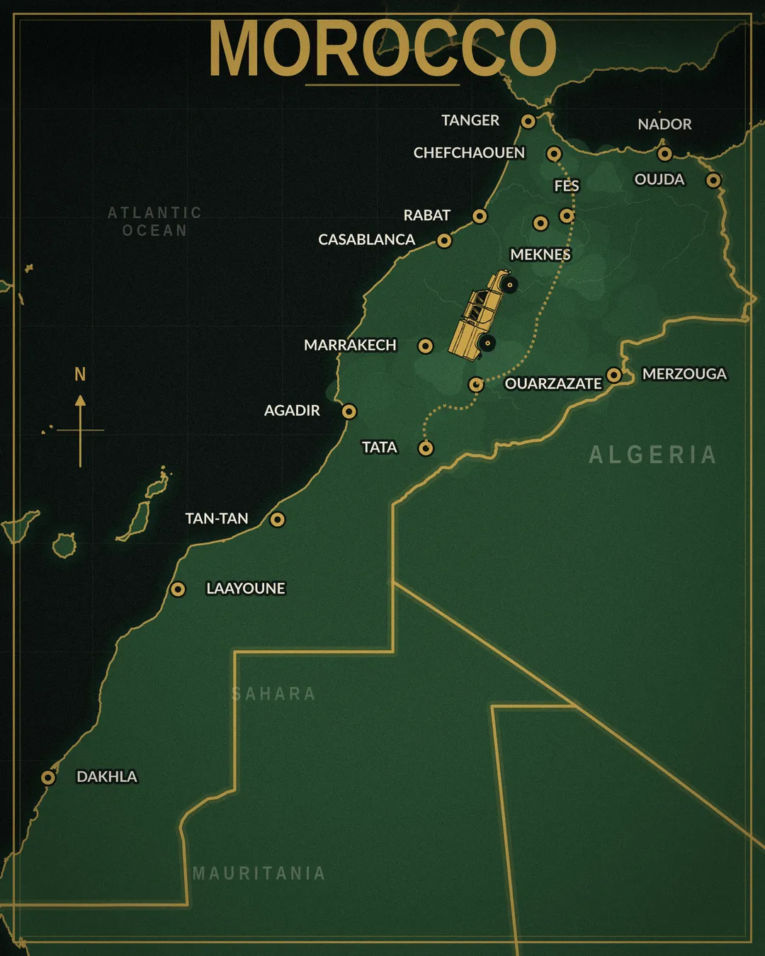
Tata → Chefchaouen
The south to north crossing, and the only high-mountain volume of the set. Canyons of the deep south, the highest pass we’ve ever taken the Defender over, then cedar forests, macaques and terraced fields.
- 1,500 km, 750 km of it offroad
- 57 waypoints, 7 alternatives
- 8 to 10 days, April to October
PDF + GPX tracks
See the roadbookDiscount applied automatically
One roadbook, two, or the whole trip
Any two roadbooks
Torn between the desert and the mountains? Take both. Nador → Tata and Tata → Chefchaouen: €99 instead of €118. A duo that includes Tata → Agadir: €119 instead of €138.
No code to enter: add them to the cart and the discount lands on its own.
All three roadbooks
€129 instead of €197. Put another way, you pay full price for the two €59 volumes, and Tata → Agadir, the €79 one, works out at €11. Close to 3,900 km of route, more than 2,300 km of it offroad.
If you were already eyeing a duo with Tata → Agadir, the full set is only €10 more. It’s the version of our Morocco offroad guide that most people heading out for three weeks or more end up taking.
The discount applies as soon as two Moroccan roadbooks are in the cart. Instant download after ordering, access with no time limit.
Field first
Morocco, taken track by track
We could have strung together cities and tarmac. We chose the opposite. For two years we came back, season after season, to log what no app shows: the forgotten tracks, the passages that need a real 4×4, the bivouac spots where you actually sleep in peace.
The result is a Morocco offroad guide in three volumes: complete itineraries, documented point by point, built to travel self-sufficiently without ever driving blind. From the dunes of the Sahara to the narrow gorges of the Atlas, from the kasbah road to the Atlantic beaches, you know where you’re going and what’s waiting.
Two years isn’t long to do things right. It’s the time it takes to drive a track across several seasons, to check it holds its promise when the wind picks up, and to confirm that a GPS point leads where it says it does. That work is finished, checked and written up clean. It’s in your hands now.

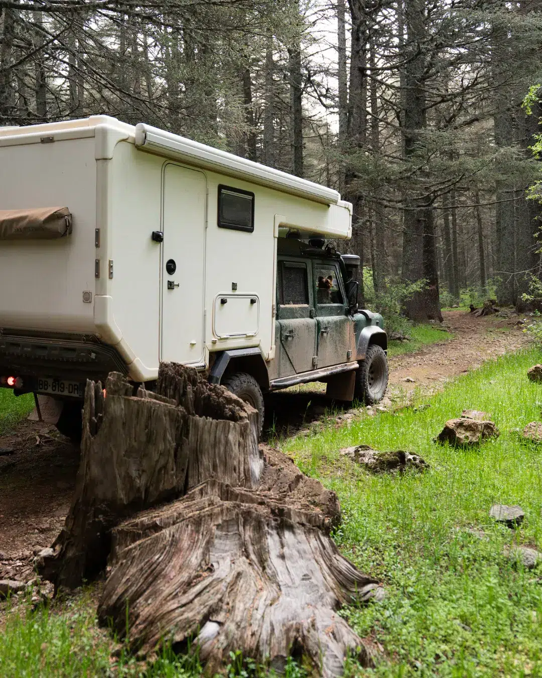
What a track log is for
Why a Morocco offroad guide changes the trip
Google Maps often stops where the adventure begins. In town, the app does the job. On the southern tracks, it offers you a route that doesn’t exist, or sends you somewhere you’ve no business being. The signal vanishes, and your margin for error with it.
A dedicated Morocco offroad guide is the opposite of a generic map: proven tracks, verified GPS coordinates, difficulty levels stated upfront, the fuel and water windows, and highlights scouted one by one. It’s the difference between a route and an adventure. To get a feel for the terrain before you buy, we share our notes in our Morocco round-up article and in our first magazine.
What the three volumes cover
Four worlds in one Morocco offroad guide
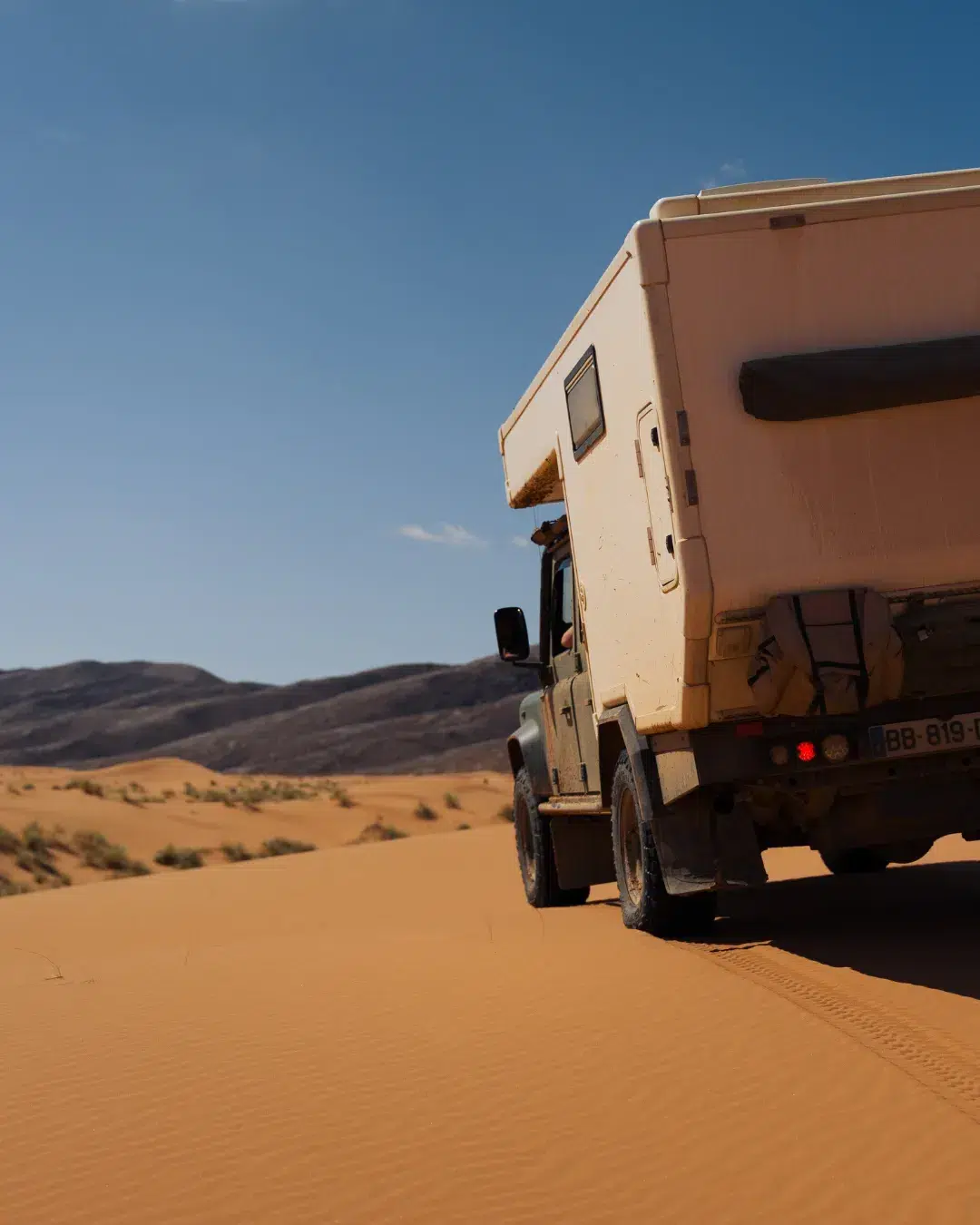
The Sahara and its dune seas
Golden sand, acacias, camels in the distance. That’s where the trip tips over. We tell you where to drive for the finest sunrise over the dunes, without the crowds.
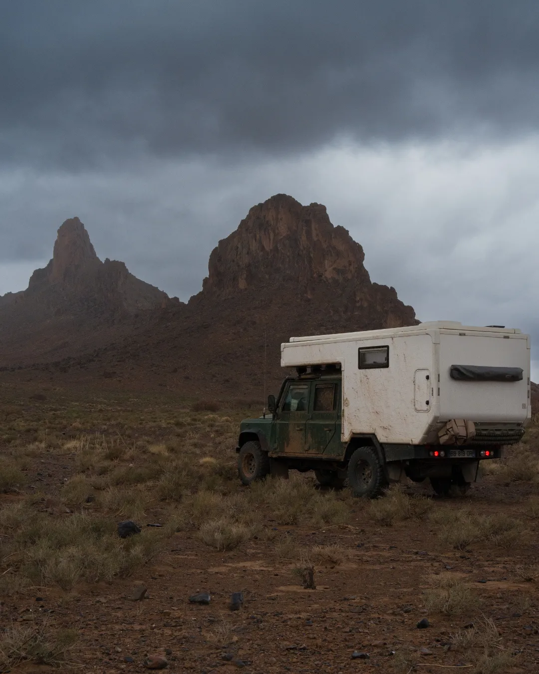
The canyons and deep-cut wadis
Walls closing in, a track that winds, a welcome coolness. Easy stages to miss if you don’t know where to pull over. The roadbook gives you the access points and the viewpoints.
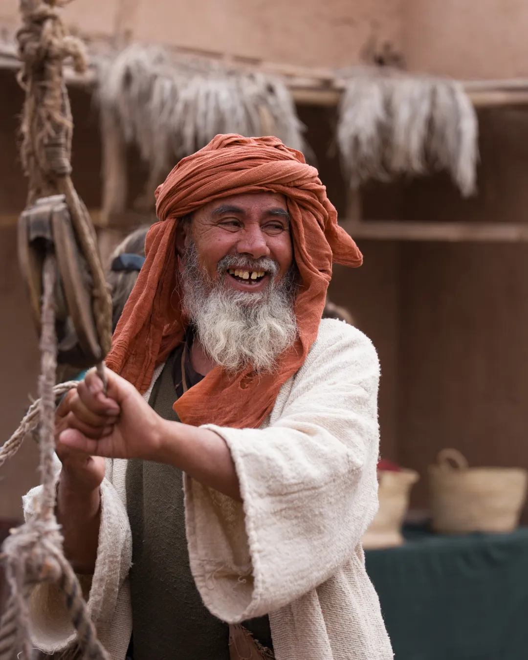
The Atlas and its 3,000-metre passes
Passes under snow into May, deep gorges, cedar forests and Berber villages clinging to the slope. The highest part of the trip, and by far the quietest.
The Atlantic and its cliffs
Beaches you can drive at low tide, fishermen’s camps, an old fort standing in the middle of nowhere. Out here you travel by the tides, not by the clock.
Our favourite part
The Atlas and its lost tracks
Between the southern dunes and the northern mountains lies the Atlas. It’s the backbone of the trip, and the part we like best. In the Middle Atlas, you drive in the shade of cedar forests, where the macaques cross the track in no hurry. Further south, the High Atlas raises its passes and its Berber villages clinging to the slope, up to kasbahs the tour coaches have forgotten.
And then there are the lost tracks. Old colonial roads, muleteer paths, links between valleys that only locals still know and that have vanished from the maps. This is where two years of scouting earns its keep: the GPS hesitates, so we test, and we come back in another season to confirm. The reward is silent passes, hamlets without a single tourist, and often a tea nobody asked for. Our Morocco offroad guide logs the ones worth the detour and still passable, saying plainly what each one demands.
All year round
The seasons in our Morocco offroad guide
Contrary to a common idea, Morocco has no single season. You just follow the regions. We go all year, adapting the route to the weather rather than the other way round.
The two southern volumes run from September to May, while the desert stays liveable. The one climbing to Chefchaouen opens from April to October, once the snow has left the high passes. Morocco works best when you follow the seasons, and our Morocco offroad guide is built that way, to send you to the right place at the right time. Releasing them now is also good timing to plan an autumn departure without rushing.
With Pixie
Travelling in Morocco with a dog
Pixie follows us everywhere, from the most remote tracks to the finest bivouacs. Bringing a dog along on the tracks takes a bit of preparation, but nothing insurmountable. You’ll need a pet passport, an up-to-date rabies vaccination with a blood titre test for the way back, ISO microchip identification and a health certificate from your vet. Allow one to two months ahead.
On the ground, daily life is simpler than you’d fear: plenty of water, shade in the hot hours, and an eye on the paw pads after a day of stones. The prep section of our Morocco offroad guide gathers the up-to-date rules and our concrete pointers, because a track Pixie signs off on is usually an excellent track.
The contents
What’s inside the Morocco offroad guide
A Morocco offroad guide is judged on its precision. Here’s what you download, no filler:
- The complete roadbook as a PDF, stage by stage, readable on phone and computer alike.
- The GPX tracks ready to load into your GPS or your app, usable with no signal.
- The mapped alternatives to bypass the technical passages or a wadi running high.
- The waypoints: bivouacs, viewpoints, tricky sections, fuel stations and campsites.
- The difficulty level of each track, stated honestly.
- The prep guide: paperwork, ferry, temporary import, water, fuel, emergency numbers.
- The rules and tips for travelling with a dog.
We don’t publish a track we haven’t driven.
Why two years
The method behind our Morocco offroad guide
Read the terrain before you’re there
Maps, satellite imagery. We draw an itinerary, then question it. Most of the routes we imagine don’t survive the first run.
Drive every kilometre
We go, for real. We note the hard spots, the resupply windows, the passages that need a real 4×4. The coordinates we keep are the ones we logged ourselves.
Sleep where we say to
Good spots can’t be judged from a photo. We spend the night. The wind, the ground, the quiet, the access at first light. And if Pixie feels at home, that’s usually a good sign.
Write it all up clean
Clear instructions, verified GPS coordinates, seasonal advice and rules for travelling with a dog. That last step is done: the three volumes are online.
Your questions
Morocco offroad guide: your questions
Is the Morocco offroad guide really available?
How do the Duo and full set discounts work?
Which one should I start with if I only take one?
Is a Morocco offroad guide really useful, or is Google Maps enough?
Which vehicles is the Morocco offroad guide suitable for?
How much time should you allow for Morocco?
Does the Morocco offroad guide work offline?
Can you do part of the route in a 4×4 van?
What languages are they available in?
Take the track, and go
The Morocco offroad guide in three roadbooks, 3,943 km of route with 2,343 km offroad, all driven by us. From €59 per volume. Two in the cart: −€19. All three: €129 instead of €197.
Instant download · See all our roadbooks · Follow us on Instagram